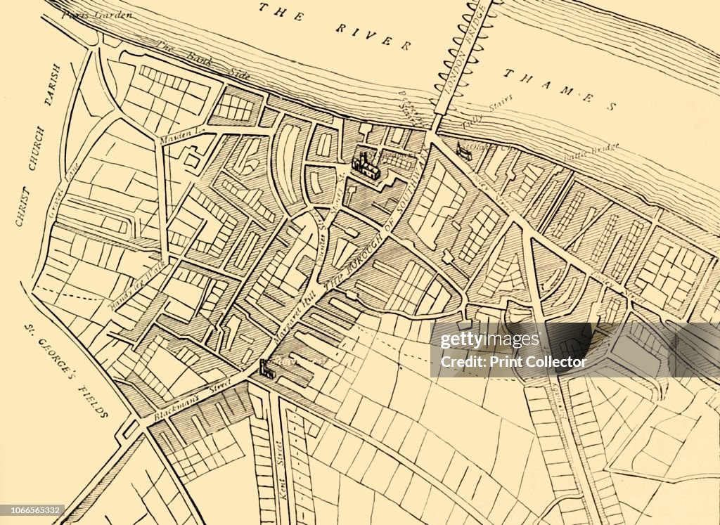
Map Of Southwark
Map of Southwark, 1720', (circa 1878). Map showing the village of Southwark on the south bank of the River Thames, in what is now part of greater London. Places shown include the Bank Side, London Bridge, Southwark Cathedral, St George's Fields and Bermondsey Street. From Old and New London: A Narrative of Its History, Its People, And Its Places. The Southern Suburbs, Volume VI, by Edward Walford. [Cassell, Petter, Galpin & Co., London, Paris & New York, circa 1878]. Artist Unknown. (Photo by The Print Collector/Getty Images)

PURCHASE A LICENCE
How can I use this image?
AED 1,850.00
AED
Please note: images depicting historical events may contain themes, or have descriptions, that do not reflect current understanding. They are provided in a historical context. Learn more.
DETAILS
Restrictions:
Contact your local office for all commercial or promotional uses.
Credit:
Editorial #:
1066565332
Collection:
Hulton Archive
Date created:
01 January, 1754
Upload date:
Licence type:
Release info:
Not released. More information
Source:
Hulton Archive
Object name:
2699370.jpg
Max file size:
5604 x 4086 px (47.45 x 34.59 cm) - 300 dpi - 6 MB
- Map,
- 18th Century,
- 18th Century Style,
- 19th Century,
- 19th Century Style,
- Avenue,
- Bankside,
- Black And White,
- Bridge - Built Structure,
- Cathedral,
- Christianity,
- Church,
- City,
- England,
- London - England,
- Monochrome,
- Physical Geography,
- Publication,
- Publisher,
- Religion,
- River,
- River Thames,
- Road,
- Southwark,
- Southwark Cathedral,
- Street,
- UK,
- Village,