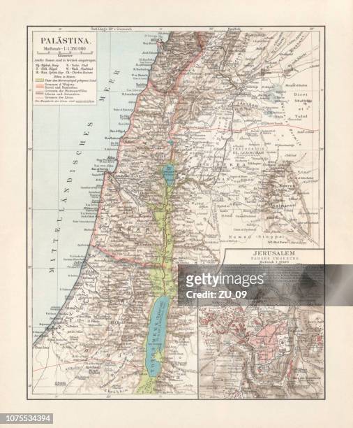
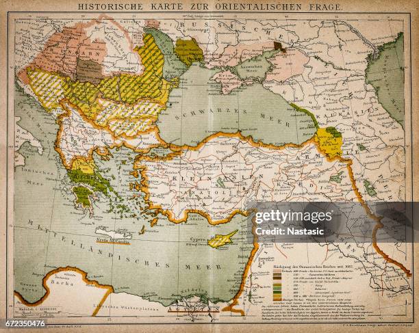
historical maps of palestine and jerusalem, lithograph, published in 1897 - damascus map stock illustrations
Palestine with Jerusalem and Damascus depicted in Jacopo Russo Map of the world 16th century circa 1528 from the 'Carte Geografiche'
Cartography, Syria, 16th century. The city of Damascus. From Civitates Orbis Terrarum by Georg Braun and Franz Hogenberg , Cologne. Engraving.
Cartography, Italy, 17th century. Province of Vicenza. From Theatrum civitatum et admirandorum Italiae by Joan Blaeu. Engraving.
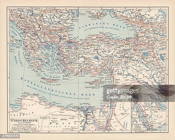
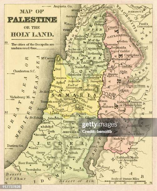
Map Of Palestine Part Of Turkey, Map Of Palestine , Circa 1902, From The 10Th Edition Of Encyclopaedia Britannica.
Rome v. Persia , circa 300 A.D.', circa 1915. Map of the eastern Mediterranean and Near East, showing the ancient empires of Rome, Persia, and...
map of eden and mount ararat, copperplate engraving, published 1774 - damascus map stock illustrations
Damascus-Mecca railway, Damascus-Mecca Railway. Plan made by Hajji Muklitar Bey compiled by Captain Omar Zekki & Lieut. Hassan Muin in the Printing...
map of syria with infographic elements of coronavirus outbreak. covid-19 data. - damascus map stock illustrations
Syrian man checks a map on his phone onboard a bus carrying civilians and fighters ahead of arriving in Qalaat al-Madiq, some 45 kilometres northwest...
Map Of Arabia With Part Of Turkey And Oman, Map Of Arabia, Turkey, Oman, Aden, With Insets Map Of Jerusalem And Palestine, Circa 1902, From The 10Th...
Georg Braun was a topo-geographer. From 1572 to 1617 he edited the Civitates orbis terrarum, which contains 546 prospects, bird's-eye views, and maps...
Israeli ambassador to the United Nations Danny Danon holds a map that he claims shows the area in Syria where Iran is recruiting and training upwards...
Israeli ambassador to the United Nations Danny Danon holds a map that he claims shows the area in Syria where Iran is recruiting and training upwards...
Syrians look, on October 24, 1973 in the streets of Damascus, at the maps which give the positions of the belligerent countries at the time of the...
diplomatic passport on north africa and mid east - damascus map stock pictures, royalty-free photos & images
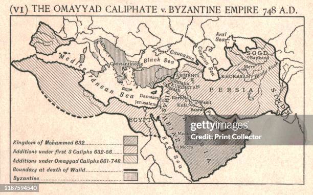
The Omayyad Caliphate v. Byzantine Empire, circa 748 A.D.', circa 1915. Map of the Mediterranean and Near East, showing the Kingdom of Mohammed,...
Rome v. Parthia, circa 50 B.C.', circa 1915. Map of the eastern Mediterranean and Near East, showing the ancient empires of Rome, Parthia, Armenia,...
Lebanese Parliament Speaker Nabih Berri points to the US seal while showing waht he presented as a US Defense Department map confirming that the...
Plan made by Hajji Muklitar Bey, compiled by Captain Omar Zekki & Lieut Hassan Muin in the Printing Works of the Ministry of Marine .
Sketch map of Syria, south of Damascus, The original title of this pen and ink map is 'Syria. East part; - south of Damascus [by] Cyril C. Graham'....
Russia's senior military officer Sergei Rudskoi sits before a map of Damascus, showing alleged strikes locations, during a briefing at the Russian...
Libyan leader Moamer Kadhafi attends a conference in Damascus 08 October 2000. The Libyan leader held talks with Egyptian Foreign Minister Amr Mussa...
Map of Damascus, Syria, coloured engraving from De praecipuis totius universi urbibus, liber secundus by Georg Braun , Simon Novellanus and Franz...
Renaissance map of Europe, Jacopo Russo detail showing the Lebanese coast with Aleppo and Damascus in Syria.
Israeli army officers study a map as they look towards Syria from the Mount Bental observation post in the Golan Heights 07 September 2007. Israel...
Syrian opposition fighters from the Failaq al-Rahman brigade check a map of the area in Jobar, a rebel-held district on the eastern outskirts of the...
Fighters from the Jaish al-Islam , the foremost rebel group in Damascus province who fiercely oppose both the Syrian regime and the Islamic State...


![Sketch map of Syria, south of Damascus, The original title of this pen and ink map is 'Syria. East part; - south of Damascus [by] Cyril C. Graham'....](https://media.gettyimages.com/id/980196856/photo/sketch-map-of-syria-south-of-damascus-the-original-title-of-this-pen-and-ink-map-is-syria-east.jpg?s=612x612&w=gi&k=20&c=T8HB8wQ3nFZATGBE51aUtIRdG7PLDQv5raHy-YPQmkU=)